
Categories
Buying a HomePublished August 21, 2026
Buying Land in Alabama: What to Check Before You Close

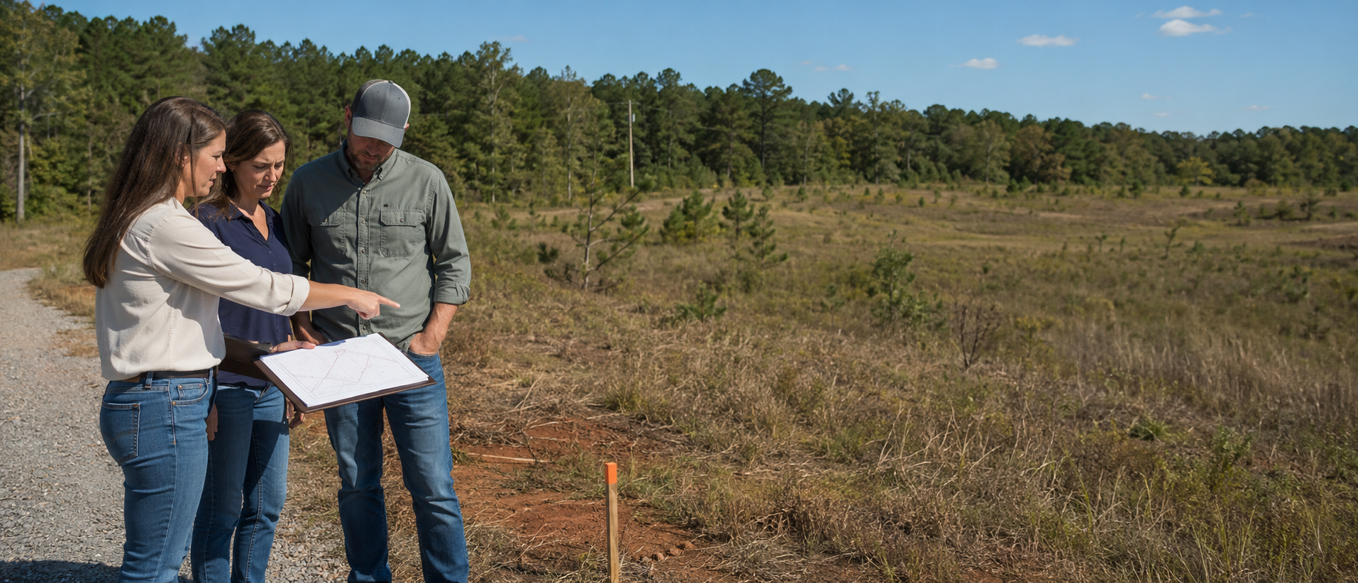
| The short answer Before buying land in Alabama, verify more than price and acreage. Confirm title, surveyed boundaries, legal and usable access, septic approval, utilities, zoning and private restrictions, flood and wetland concerns, topography, mineral rights and any lake-specific permits. Put the investigations, access rights and deadlines you need into the purchase agreement. A parcel is not proven buildable because a listing calls it buildable. |
Vacant land can look simpler than a house because there is less to inspect. In practice, land often requires more separate answers. A home already demonstrates that somebody obtained access, placed utilities and built on the site. A vacant parcel may still need every one of those assumptions proven.
That difference matters in North Central Alabama. Two tracts on the same road can have different deeds, easements, soil conditions, utility costs or restrictions. A Smith Lake lot can have beautiful water frontage and still have a difficult house site, limited septic area or no approval for the dock a buyer has in mind. A wooded Walker County tract can appear private and usable while an old road, severed mineral interest or mine history deserves more investigation.
Alabama law also places a meaningful investigation burden on land buyers. The Alabama Supreme Court has reaffirmed that caveat emptor applies to unimproved land. Our separate Alabama buyer-beware guide explains the broader disclosure rule and recognized exceptions. For land, the practical response is straightforward: ask specific written questions, hire the right professionals and make the contract protect enough time to get real answers.
Start with the intended use, not the acreage
The first land-buying question is not 'How many acres?' It is 'What must this property allow me to do?' A parcel that works for hunting may not work for a four-bedroom house. A homesite that supports one septic system may not support a second dwelling. A waterfront lot that works for a cabin may not fit a large house, detached garage and full-size dock.
Write a one-page use plan before comparing tracts. Include the dwelling type, bedroom count, manufactured or modular construction if relevant, outbuildings, driveway, animals, farming or timber use, subdivision plans, rental plans, internet needs and lake improvements. Give that same description to the local authority, utility provider, soil professional, surveyor, lender and closing attorney. Different answers often surface when the intended use becomes specific.
| A better question Do not ask only, 'Is the land buildable?' Ask, 'Can this exact parcel support my planned three-bedroom home, driveway, septic field and replacement area, well or water line, power extension and any planned shop or dock under the current rules and recorded restrictions?' |
Alabama land is buyer-beware territory
Alabama appellate decisions state that caveat emptor applies to the purchase of unimproved land. That does not give anyone permission to make false statements, and the facts, written questions, relationships and contract still matter. It does mean a buyer should not assume the seller must discover every limitation or volunteer every answer the buyer cares about.
Treat listing remarks as leads to verify, not as final proof. Words such as 'unrestricted,' 'utilities available,' 'ready to build,' 'good access,' 'perc tested,' 'subdividable' or 'dockable' can hide important qualifications. Ask what document supports each claim, who issued it, which parcel it applies to, when it was issued and whether it remains current.
· Ask material questions in writing and keep the replies with the transaction record.
· Have an Alabama real estate attorney review unfamiliar as-is, non-reliance, access or due-diligence language before signing.
· Do not waive a needed investigation because the parcel is inexpensive or the purchase is cash.
Verify title, the legal description and what actually conveys
The county tax map is useful for locating a parcel, but it is not a substitute for the recorded deed, legal description, title work or survey. Before closing, the title and closing professionals should confirm the seller's ownership, the correct legal description, recorded liens and exceptions, easements, restrictions and the form of deed to be delivered.
Land can also be divided into separate bundles of rights. Mineral rights, timber rights, hunting rights, conservation easements or utility rights may have been reserved or conveyed in earlier documents. Do not assume every right comes with the surface simply because the listing does not mention a reservation. Ask the closing attorney or title professional what the search shows, what is excluded and what an owner's title policy would and would not cover.
If the tract comes from a larger parent parcel or has a long metes-and-bounds description, confirm that the contract, survey, deed and title commitment all describe the same property. A street address or parcel number alone is not a legal description.
Order a current boundary survey when the boundaries matter
A survey can locate record boundary lines and corners, show visible encroachments and improvements, and help connect the legal description to the land on the ground. Depending on the assignment, it may also show easements, rights-of-way, flood information, topography or lake elevations. Tell the surveyor what decisions the survey must support instead of assuming every survey includes the same work.
Old fences, tree lines, pins found by a neighbor, phone maps and county GIS lines are not reliable substitutes for a survey. GIS parcel layers are often designed for tax administration and general reference. They can be offset from physical features. A fence may follow convenience, not the deed line.
· Walk the lines and corners with the survey when practical.
· Ask the surveyor to identify conflicts between occupation lines and record lines.
· For a planned build, discuss a topographic or site-plan survey in addition to a boundary survey.
· For Smith Lake, ask which shoreline and elevation references the architect, septic designer and Alabama Power will need.
Legal access and practical access are different questions
A parcel needs a lawful route to the property, but a recorded easement does not automatically provide an affordable driveway. Verify whether access comes from public-road frontage, a recorded ingress and egress easement, a shared private road or another arrangement. Then verify whether the route is wide enough, located where expected and available to utilities, construction vehicles, emergency services and the intended level of use.
A driveway may need a culvert, sight-distance review, grading, drainage work or an access permit from the authority that controls the road. A steep or wet entrance can be expensive even when the parcel fronts a public road. On a private road, review who maintains it, how costs are shared, whether there is a written agreement and whether the lender accepts the arrangement.
| Proof to obtain A recorded access document or confirmed public frontage, the survey location, the controlling road authority's response, any private-road agreement, and a contractor's practical assessment when major clearing, drainage, bridge or culvert work may be needed. |
Septic approval is a buildability question, not a footnote
If public sewer is not available, septic feasibility should move near the top of the due-diligence list. The Alabama Department of Public Health advises buyers to check before purchasing because some lots are not suitable for onsite sewage disposal. Shallow soil, slow drainage, wet conditions, bedrock, slope, lot size and the proposed home can change the design or prevent a conventional system.
A casual statement that land 'perced' is not the same as a current permit for the home you plan to build. Ask for the complete site evaluation, plot plan, application, permit status and any expiration or transfer questions. Confirm that the evaluated area is inside the parcel, outside conflicting easements and compatible with the house, driveway, well, dock path and required replacement area.
ADPH explains that a registered professional performs the soil and site evaluation and system design, the local health department reviews the submission, and a permit to install is required before installation. Difficult sites may require an engineered system. The cost difference and maintenance obligations can materially affect the purchase decision.
Soil maps and a perc result are screening tools. A parcel-specific site evaluation and health-department permit process determine what can actually be installed.
USDA's Web Soil Survey is useful for early screening of slope, depth to bedrock, wetness and other soil limitations. It does not replace the field evaluation or health-department decision. Humphries Group also maintains a local septic and sewer services resource page. Vendor selection and the professional scope remain the buyer's decision.
Confirm every utility by parcel, capacity and cost
A utility line visible across the road does not prove the parcel can connect. Contact the actual provider with the parcel number, road location and intended use. Ask whether service is available at the boundary, whether capacity is available, what easements are required, who pays for extensions and taps, and what construction or inspection must occur first.
· Public water: provider, line location, meter or tap availability, pressure, fees and extension cost.
· Private well: likely drilling conditions, placement conflicts, testing and ongoing owner responsibility for water safety.
· Electricity: serving utility, nearest usable connection point, clearing, poles, underground-service requirements and construction contribution.
· Internet and cellular service: verify at the site. A provider's coverage map or a neighbor's service does not guarantee the same result on the parcel.
· Propane and trash service: delivery access, tank placement, pickup location and private-road limitations.
For an existing private well, Alabama Public Health recommends routine testing and explains that county health departments can assist with bacteriological samples. For vacant land, well planning should be coordinated with the home, septic field and access plan before those areas compete for the same usable ground.
Check zoning, jurisdiction, subdivision rules and private restrictions
Land-use rules can change when a parcel crosses a city limit, planning jurisdiction or subdivision boundary. Confirm the exact jurisdiction before relying on a general statement about the county. Gardendale, for example, maintains zoning maps and regulates building and property use through its Inspection Services and Planning and Zoning functions. A rural parcel outside municipal limits may follow a different process.
Ask the applicable office whether the intended dwelling and accessory uses are allowed, what setbacks apply, whether manufactured homes or multiple dwellings are permitted, what driveway or building permits are needed, and whether subdivision approval is required. Then review recorded covenants, architectural rules, minimum-size requirements, rental limits, road agreements and association obligations separately. Government approval does not cancel private restrictions, and private approval does not replace government permits.
| Be careful with the word 'unrestricted' It usually means the seller or agent is not aware of certain private deed restrictions. It does not mean the land is exempt from septic rules, floodplain requirements, environmental law, access permits, utility easements, building codes or every recorded reservation. |
Screen floodplain, wetlands, streams and drainage separately
Use FEMA's Flood Map Service Center to screen mapped flood zones and base-flood information, then contact the local floodplain administrator about the planned work. A map is one part of the answer. The homesite may be high while the only driveway crosses a low area, or a small stream and culvert may control practical access after heavy rain.
Wetlands and regulated waters are a separate question. A parcel can contain wetlands outside a mapped FEMA flood zone. EPA explains that wetland identification considers hydric soils, wetland vegetation and hydrology, and the U.S. Army Corps of Engineers handles jurisdictional determinations under the current federal framework. Dredging, filling or placing a road across regulated waters may require authorization. In Alabama, ADEM coordinates state water-quality certification for applicable federal permits.
· Walk the parcel after ordinary rain when possible and look for ponding, debris lines, scoured channels and saturated ground.
· Ask whether the road, proposed driveway, septic field or house site crosses a drainage feature.
· If maps or field conditions raise concern, use a qualified surveyor, engineer or environmental consultant rather than guessing from aerial imagery.
Topography and site work can change the real price
The purchase price is only the first land cost. Clearing, grading, erosion control, retaining walls, long driveways, rock excavation, culverts, bridges, utility extensions and engineered septic can turn a bargain parcel into an expensive project. Before the due-diligence deadline, ask a builder or site contractor to walk the likely house and driveway areas with the survey and soil information.
Slope is especially important around Smith Lake and other wooded ridges. A dramatic view may come with a narrow building envelope, difficult equipment access and a long path between the house, septic field and water. Plan those components together. Solving one at a time can leave the final component without a workable location.
Investigate mineral, timber and mine-history questions
Mineral rights can be severed from the surface estate, and timber may be subject to a separate contract or recent harvest plan. Ask the title professional to identify recorded reservations and exceptions. If timber value affects the price, use a consulting forester to evaluate species, volume, access and the terms of any existing arrangement.
Walker County and nearby coal-producing areas deserve an additional screen for historic surface or underground mining. The Alabama Surface Mining Commission provides regulatory and geospatial resources for permitted coal mining. The Alabama Department of Workforce's Abandoned Mine Land program maintains an underground mine map repository and addresses hazards such as subsidence, dangerous highwalls, mine fires and affected water supplies from historic mining.
A map search is a starting point, not an engineering conclusion. If a parcel, access route or proposed homesite is near mapped or suspected mining activity, ask the appropriate agency and a qualified geotechnical or engineering professional what additional review is justified.
Smith Lake land needs a shoreline-specific review
Waterfront ownership does not automatically guarantee the dock, boathouse, seawall, dredging or shoreline work a buyer wants. Alabama Power states that work in the lakebed, its flood easement or control strip may require a permit. The online request begins the process but is not itself a permit. Required application materials can include signed guidelines, a recorded deed, a dimensioned drawing and applicable subdivision approvals.
Alabama Power also states that lots with less than 100 feet of shoreline may be restricted or may not be eligible for structures. That is a screening statement, not approval for a particular lot. Contact the Smith Lake Shorelines office with the survey, deed and specific plan before treating a dock as feasible.
· Verify the actual surveyed shoreline and the relevant elevation references.
· Ask for permits, approved drawings and transfer paperwork for every existing dock, boathouse, walkway, seawall or shoreline improvement.
· Check water depth and usable access during lower lake levels, not only the conditions seen on showing day.
· Coordinate the house site, septic design, stairs or tram, driveway and shoreline plan.
· Review subdivision or association restrictions in addition to Alabama Power requirements.
For background on how the lake and its communities developed, see The History of Smith Lake, Alabama. Use Alabama Power's current permit guidance, not a historical or marketing article, for a live shoreline decision.
Financing should match the land and the build plan
Vacant-land lending can differ from a mortgage on a completed home. Down payment, appraisal, loan term, interest rate, required surveys and acceptable access can vary by lender and parcel. A construction-to-permanent loan adds the builder, plans, budget, appraisal and draw schedule. Talk with a land or construction lender before the offer so the contract timeline reflects the lender's actual requirements.
Cash removes the lender's conditions, not the property's risks. A cash buyer still needs title work, survey decisions, access, septic, utilities, restrictions, environmental review and a realistic development budget. If resale is part of the plan, consider what a future financed buyer will require even if the current purchase uses cash.
Build the due-diligence period around the slowest answer
A short generic inspection period may not be long enough for a survey, soil professional, health-department review, utility engineering, shoreline response or wetland consultation. Before making the offer, ask how long the key professionals currently need. The contract should state the investigations allowed, the buyer's access rights, the deadline, any restoration obligation after testing, and the buyer's options if the parcel does not work.
Do not assume a financing contingency covers a failed septic plan or an unacceptable access easement. Do not assume an appraisal proves buildability. The contract controls the buyer's options, and an Alabama attorney should explain the language when the risk or structure is unfamiliar.
The proof-to-obtain checklist
| Question |
Who can verify |
Useful proof before closing |
| What land and rights convey? |
Closing attorney, title professional |
Title commitment or opinion, deed, legal description, exceptions and owner's-policy discussion |
| Where are the boundaries? |
Licensed surveyor |
Current survey, marked corners and any identified encroachments or conflicts |
| Can I legally and physically reach it? |
Attorney, surveyor, road authority, contractor |
Recorded easement or frontage, survey location, permit response and private-road agreement |
| Can the planned home use septic? |
Registered site professional and county health department |
Site evaluation, plot plan, design and permit status for the intended use |
| Can utilities serve the parcel? |
Each serving provider |
Written availability, connection point, easement needs, capacity and cost estimate |
| Is my use allowed? |
City or county office and closing attorney |
Zoning confirmation, permit path, recorded restrictions and association documents |
| Do flood, wetlands or drainage limit the plan? |
Floodplain administrator, engineer, environmental consultant, Corps/ADEM when applicable |
Effective map, site elevations, delineation or agency response appropriate to the concern |
| What will site work cost? |
Builder, civil engineer or site contractor |
Concept plan and written estimates for clearing, grading, driveway, drainage and utilities |
| Are mine or mineral issues present? |
Title professional, ASMC, ADOW-AML, engineer |
Recorded reservations, map screening and any recommended site-specific review |
| What can I build at Smith Lake? |
Alabama Power Shorelines plus local authorities |
Survey, written permit guidance, existing permits and approved plans |
Local due-diligence priorities in our service area
| Local market |
Questions to move near the top |
| Jasper and Walker County |
Recorded access, septic or well, topography, mineral reservations, historic mine maps, manufactured-home plans and long rural utility extensions |
| Gardendale and North Jefferson |
Exact city or county jurisdiction, zoning and setbacks, sewer versus septic, drainage, road access and utility capacity |
| Cullman and Crane Hill |
Acreage boundaries, subdivision restrictions, septic, public-water reach, manufactured or modular home rules, barns, animals and driveways |
| Smith Lake in Walker, Cullman and Winston counties |
Shoreline footage, Alabama Power permits, existing dock records, lower-water access, slope, septic area, road quality and the coordinated house-to-water plan |
These are investigation prompts, not claims that every parcel in an area has a problem. The deed, survey, intended use, physical site and responsible authority should determine the actual work.
A practical buyer playbook
· Define the intended use, essential improvements and non-negotiable features before comparing parcels.
· Obtain the parcel number, deed reference, available survey, restrictions, utility information, soil records and existing permits before or immediately after making an offer.
· Visit the property with appropriate permission. Walk the likely access, boundaries, homesite, drainage features and utility route rather than viewing only from the road.
· Build the offer around parcel-specific contingencies and a realistic timeline for the slowest investigation.
· Use separate professionals for title, survey, septic, engineering, environmental, lending and construction questions. No single professional replaces the others.
· Track every unresolved item in writing. A verbal 'should be fine' is not a closing document.
· Review the final survey, title package, loan terms, permits and closing documents before funds are due.
· Complete a final visit to confirm no material physical change, new dumping, timber removal or access obstruction has occurred.
Humphries Group's Alabama home-buying page explains the broader purchase process. For the sequence from accepted offer through recording, see our real estate closing process guide. Land transactions need the same discipline with more site-specific specialists.
A practical seller playbook
· Locate the deed, prior survey, access documents, restrictions, soil or septic records, utility correspondence, leases, timber or mineral documents and lake permits before listing.
· Mark what is verified, what is based on an older record and what remains unknown. Do not turn an assumption into a marketing fact.
· Give the listing agent accurate access instructions and disclose known hazards that could make a showing unsafe.
· Decide whether a new survey, brush clearing at corners, soil evaluation or utility confirmation would reduce buyer uncertainty and improve marketability.
· Answer specific written questions carefully from actual knowledge and route legal questions through the closing attorney.
· Preserve the property during the contract period. Address dumping, unauthorized access, timber cutting or road damage promptly.
Frequently asked questions
What should I check before buying land in Alabama?
Verify title and the legal description, boundaries, legal and practical access, septic or sewer, water and electric service, zoning and recorded restrictions, flood and wetland concerns, topography and site-work cost, mineral and timber rights, financing, and any lake-specific permits. The exact list should follow your intended use.
Does Alabama require a seller to prove land is buildable?
Do not assume that. Alabama applies caveat emptor to unimproved land, and contract wording and specific facts matter. A buyer should independently verify the approvals and physical conditions needed for the planned use and obtain legal advice about the agreement.
Is a perc test enough to know I can build?
No. A perc result or soil map is not the same as final approval. Confirm the parcel-specific site evaluation, system design, plot plan and local health-department permit path for the planned home and bedroom count.
Do I need a survey to buy land in Alabama?
A survey is not automatically the same requirement in every transaction, but it is often the most reliable way to connect the deed to the ground, locate boundaries and evaluate access, encroachments and planned improvements. The lender, title professional, attorney and intended use may affect the scope needed.
What if the land is landlocked?
Do not rely on a neighbor's permission or an informal path. Have an Alabama attorney and surveyor review recorded access and the parcel history. Legal remedies such as an easement by necessity are fact-specific and are not a substitute for confirming dependable access before closing.
Can I put a manufactured home or RV on unrestricted land?
Not necessarily. Verify the exact jurisdiction, septic or sewer requirements, building and installation rules, driveway access, utility requirements and any recorded restrictions. 'Unrestricted' is not a universal exemption.
Can I divide the land later?
Maybe, but a seller's statement is not approval. Ask the applicable planning or subdivision authority about minimum lot size, road frontage, access, utility and septic standards, survey and plat requirements, and any private restrictions before pricing the tract around a future split.
Does every Smith Lake lot qualify for a dock?
No. Alabama Power reviews shoreline work and says lots with less than 100 feet of shoreline may be restricted or may not qualify for structures. The survey, shoreline geometry, location, existing improvements and current guidelines all matter. Obtain parcel-specific written guidance.
Can a cash buyer skip due diligence?
Cash can simplify financing, but it does not solve title, access, septic, utility, flood, wetland, restriction, mine-history or shoreline problems. Cash buyers should complete the same parcel-specific investigation.
Who should be on my land-buying team?
Depending on the parcel: a local real estate agent, Alabama closing attorney or title professional, licensed surveyor, registered soil or septic professional, county health department, lender, builder or site contractor, engineer, environmental consultant, utility providers and the authority responsible for zoning, roads or shoreline work.
The bottom line
Good land due diligence is not about finding a reason to reject every parcel. It is about replacing expensive assumptions with documented answers while the contract still gives the buyer choices. The strongest purchase is one in which the intended use, deed, survey, access, septic plan, utilities, restrictions and development budget tell the same story.
A listing can tell you why a parcel deserves a closer look. It cannot prove the parcel will support your plan. Slow down long enough to identify the deciding questions, assign each one to the right professional and resolve them before closing.
| Planning to buy land in Alabama? Humphries Group can help you organize the parcel questions, local contacts and contract timeline before you commit. Call (205) 202-0082 or visit kwalabama.com to start a practical, property-specific conversation. For legal advice, title interpretation, engineering, septic approval or environmental determinations, use the appropriately licensed professional or responsible agency. |
Sources and methodology
Research verified August 20, 2026. This article prioritizes current government and primary legal sources, then translates them into a practical real estate checklist for North Central Alabama. It does not declare a parcel buildable and is not legal, surveying, engineering, environmental, septic or lending advice.
· DeAravjo v. Walker (Alabama Supreme Court, 1991). Reaffirms that caveat emptor applies to the purchase of unimproved land.
· Clay Kilgore Construction, Inc. v. Buchalter/Grant, L.L.C. (Alabama Supreme Court, 2006). Discusses caveat emptor and as-is language in a vacant-lot transaction.
· Can I Live on This Lot? (Alabama Department of Public Health, accessed August 20, 2026). Explains why buyers should check sewer or soil suitability before purchase and the permit-to-install process.
· Soil and Onsite Sewage (Alabama Department of Public Health, updated June 11, 2026). Current state program entry point for onsite sewage coordination and guidance.
· Web Soil Survey (USDA Natural Resources Conservation Service, accessed August 20, 2026). Provides current soil survey data for screening land-use limitations.
· Well Water (Alabama Department of Public Health, updated June 23, 2026). Explains owner responsibility and county-assisted bacteriological testing for private wells.
· FEMA Flood Map Service Center (Federal Emergency Management Agency, accessed August 20, 2026). Official public source for NFIP flood hazard maps and products.
· What Is a Jurisdictional Delineation under CWA Section 404? (U.S. Environmental Protection Agency, updated May 11, 2026). Explains wetland delineation criteria and Corps verification.
· Clean Water Act Section 401 Water Quality Certification (Alabama Department of Environmental Management, accessed August 20, 2026). Explains Alabama's role alongside federal Section 404 permits.
· Alabama Surface Mining Commission (accessed August 20, 2026). Official regulatory and geospatial entry point for surface and underground coal mining records.
· Abandoned Mine Land Reclamation (Alabama Department of Workforce, accessed August 20, 2026). Describes the underground mine map repository and historic mine hazards including subsidence.
· Lakeshore Use Permit Request (Alabama Power Shorelines, accessed August 20, 2026). Explains when shoreline permits may be required, application materials and the less-than-100-foot shoreline screening rule.
· Smith Lake Shorelines Office (Alabama Power Shorelines, accessed August 20, 2026). Lists the current Smith Lake shoreline contact information.
· Gardendale Zoning Maps and Inspections (City of Gardendale, accessed August 20, 2026). Illustrates why jurisdiction-specific zoning and permitting must be confirmed for the exact parcel.

Justin Humphries
Team Leader | Keller Williams | The Humphries Group | Alabama Real Estate
or another way